GPX maps tell you where a road goes — TrailDB tells you what it feels like. Community shared trail conditions, geotagged surface photos, hazards, and trail ratings submitted by real riders.
Standard cycling apps treat all unpaved roads the same. A line on the map could be silky champagne gravel or tyre-slashing fist-sized rocks.
Satellite imagery is months out of date. TrailDB's spotter intel provides recent, ground-level photos showing season-specific conditions, mud, or bump fields.
Wondering whether to run 38mm fast slicks or 57mm MTB tyres? Check verified trail photo conditions and spotter reviews before guessing.
Every photo upload extracts GPS coordinates or uses a ridden GPX route to pinpoint the recon location, taking out the guesswork. This helps keep data accurate and helps others plan and check their routes.
Everything you need to scout, catalogue, and conquer unfamiliar trails.
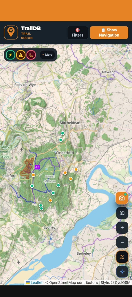
Explore trail intel worldwide with cycling maps, surface trail info, and hazards.
Snap photos mid-ride or share directly from your phone's gallery. In-app photos capture GPS, which can be uploaded after the ride. Or link to a GPX or Strava activity for gallery-selected photos.
Find hazards on your route or alert other riders to issues with the trail. No unwanted surprises on your rides.
Download verified GPX trails with embedded waypoint intel directly to Garmin, Wahoo ELEMNT, Hammerhead Karoo, or Coros computers.
When the app is fully released: Access to inspect all photos and terrain notes immediately with zero account walls. Sign up only when you're ready to submit intel and earn scout XP.
Built as a modern Progressive Web App. Fast, responsive, and functional in areas with no signal when scouting on the trail.
High-contrast dark mode for direct sunlight readability on the trail.
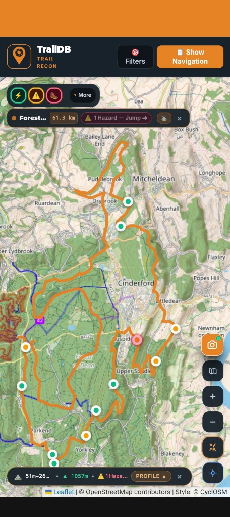
Live route tracking, elevation profiling, and pinned surface intel along your track.
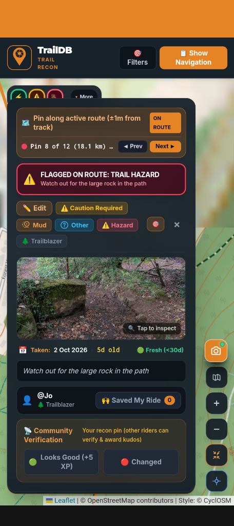
Real-time hazard warnings, surface classification, and spotter photo verification.
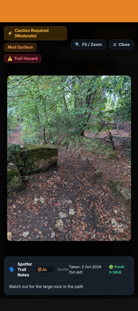
High-resolution ground-truth inspection with spotter notes and zoom capabilities.
Standard routing treats every unpaved path the same. TrailDB shows the community classification of the route across three pillars: Trail Surface, Trail Type, and Rideability Status with clear on-trail hazard warnings.
Example of TrailDB scout app options — fast, tactile classification on the trail.
Smooth tarmac road, shared path, or dedicated cycle path. Zero loose stone, maximum rolling efficiency, suitable for all tyre types and bikes.
Rolled gravel, compacted dirt, and firm crushed stone. Fast, flowing, and predictable. The 'champagne gravel' for fast gravel cycling.
Deep pea gravel, loose stones, and washboard corners. Squirrely cornering traction requiring lower pressures and wider rubber.
Farm field paths, meadow tracks, and turf bridleways. Moderate to high rolling drag; spongey in spring, firm and bumpy in high summer, slick when wet.
Saturated clay, swampy ruts, standing water, and boggy sections. Wheel-clogging potential - check your tyre clearance!
Exposed roots, rocky trails, steep loose drops. Demands technical bike handling and high tyre volume. Handling skills or an MTB needed!
Public paved roads, quiet rural lanes, or unclassified rights-of-way.
Multi-use greenways and paths shared with pedestrians, dog walkers, and runners.
Dedicated, segregated cycle tracks and official cycling infrastructure.
Farmland, field tracks, and grassy paths crossing parkland.
Narrow singletrack, one bike wide.
Doubletrack fire roads, tractor dual ruts, and forestry access roads.
Public bridleways open to cyclists, walkers, and horse riders.
Canal towpaths, bridge crossings, old railway lines, or unclassified ways.
Dry, predictable, and firmly packed.
Loose deep gravel, bumpy, potholes, or roots. Slow down and choose lines carefully.
Deep mud, flooded trails, dense overgrowth, or extreme rock climbs. Dismounting and pushing required.
High-priority warning alerting route scouts to physical trail blocks before they set out on the ride.
Every photo recon upload, surface report, and verified hazard pin earns you Scout XP. As your contributions are upvoted by riders, you unlock veteran spotter badges and contributor rankings.
Climb through recognition tiers based on photo accuracy and community upvotes.
Earn peer kudos from fellow gravel riders when your photo pins and hazard warnings save their day.
TrailDB runs directly inside your mobile browser as a Progressive Web App (PWA) with full offline caching support. Android App and iOS App coming soon.
TrailDB is built on transparent, rider-first privacy principles. We don't sell your location history, monetise your routes, or lock your contributions behind walled gardens.
Robust 2FA account protection safeguards your login, verified scout handle, and earned XP from unauthorised access.
Strict compliance with UK and European GDPR privacy standards. You retain 100% legal ownership and control over your personal data.
Complete self-service privacy controls. Permanently wipe all your uploaded scout photos, pins, and tracklogs in a single click whenever you wish.
GPS coordinates are verified locally on your device. Sensitive camera metadata is stripped on-device prior to upload.
Review our complete privacy policy, data protections, and rider rights.
No! When we have moved out of Beta you can browse the map, inspect surface photos, check elevation profiles, and view spotter notes completely anonymously for free. You only create an account when you want to upload photos, contribute intel, and earn scout XP. Stay tuned for when this will be available.
When you snap a trail from the app your location is recorded there and then. Alternatively upload a photo, TrailDB reads unredacted EXIF camera metadata directly on your device. If this isn't available then add the completed GPX file from your ride and the app does the rest.
Yes. Routes scouted on TrailDB can be exported directly as GPX files and saved to bike computers or loaded into third-party navigation apps.
traildb.cc is our community and marketing page (the site you are viewing right now). traildb.app is the live application engine where map, photo uploading, route saving, and account authentication takes place.
Start exploring gravel routes and surface intel right now. No credit card, no paywall, no hassle.