GPX maps tell you where a road goes — TrailDB tells you what it feels like. Community shared trail conditions, geotagged surface photos, hazards, and trail ratings submitted by real riders.
Compact limestone with loose corners. Ideal for 40mm+ tires.
Standard cycling apps treat all unpaved roads the same. A line a on the map could be silky champagne gravel or tire-slashing fist-sized rocks.
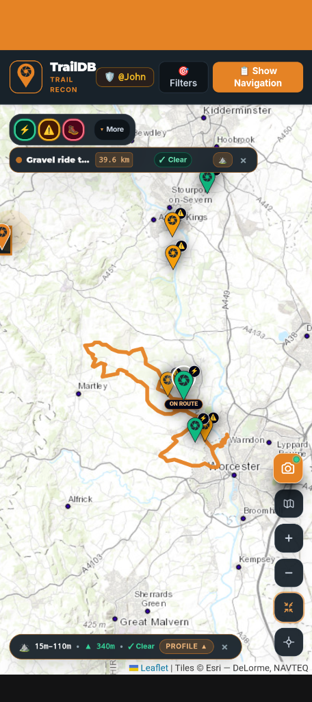
Satellite imagery is months out of date. TrailDB's spotter intel provides recent, ground-level photos showing season specific conditions, mud, or bump fields.
Wondering whether to run 38mm fast slicks or 57mm MTB tyres? Check verified trail photo conditions and spotter reviews before guessing.
Every photo upload extracts GPS coordinates or uses a ridden GPX route to pin point the recon location. Taking out the guess work to locate the intel. This helps keep data accurate and helps others plan check their routes.
Everything you need to scout, catalog, and conquer unfamiliar trails.
Explore trail intel worldwide with cycling maps, surface trail info, and hazards.
Snap photos mid-ride or share directly from your phone's gallery. In-app photos capture GPS, which can be uploaded after the ride. Or link to a GPX or Strava activity for gallery selected photos.
Find hazards on route or alert other riders to issues with the trail. No unwanted surprises on your routes.
Download verified GPX trails with embedded waypoint intel directly to Garmin, Wahoo ELEMNT, Hammerhead Karoo, or Coros computers.
When the App is fully released: Access to inspect all photos, and terrain notes immediately with zero account walls. Sign up only when you're ready to submit intel and earn scout XP.
Built as a modern Progressive Web App. Fast,responsive,and functional in no signal areas when scouting on trail.
High-contrast dark mode for direct sunlight readability on the trail.
Live route tracking, surface pins, and elevation profile charts.
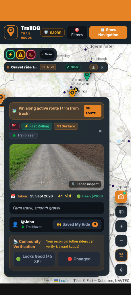
Gravel trail classification, spotter notes, and condition updates.
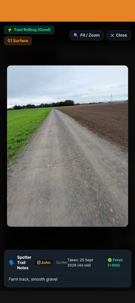
Zoom in on rocks, ruts, and trail conditions with Hi-Res details.
Simple gravel grading helps riders assess tire widths, tire pressure, and route viability.
Smooth, hard-packed limestone or crushed gravel with minimal loose stones. Suitable for road endurance bikes and 32–38mm tires.
Typical farm and forestry roads with occasional loose pebbles, light washboarding, and small ruts. 38–42mm gravel tires recommended.
Deep gravel, fist-sized chunky stones, potholes, and steep loose pitches. 45–50mm tires or mountain bike treads advised.
Unmaintained doubletrack, baby-head rocks, deep sandy washouts, and hike-a-bike sections. 2.1"+ mountain bike tires or rigid rig setup.
Every photo recon upload, surface report, and verified hazard pin earns you Scout XP. As your contributions are upvoted by riders, you unlock veteran spotter badges and contributor rankings.
Climb through recognition tiers based on photo accuracy and community upvotes.
Two-factor authentication (2FA) account protection, GDPR data compliance, and one-click bulk photo removal.
TrailDB runs directly inside your mobile browser as a Progressive Web App (PWA) with full offline caching support. Android App and iOS App coming soon.
No! When we have moved out of Beta you can browse the map, inspect surface photos, check elevation profiles, and view spotter notes completely anonymously for free. You only create an account when you want to upload photos, contribute intel, and earn scout XP. Stay tuned for when this will be available.
When you snap a trail from the app your location is recorded there and then. Alternatively upload a photo, TrailDB reads unredacted EXIF camera metadata directly on your device. If this this isn't available then add the completed GPX file from your ride and the APP does the rest.
Yes. Routes scouted on TrailDB can be exported directly as GPX files and saved to bike computers or loaded into third-party navigation apps.
traildb.cc is our community and marketing page (the site you are viewing right now). traildb.app is the live application engine where map, photo uploading, route saving, and account authentication takes place.

Start exploring gravel routes and surface intel right now. No credit card, no paywall, no hassle.